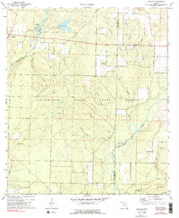
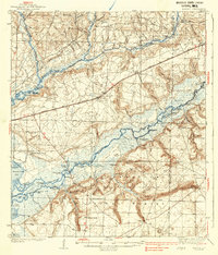
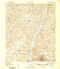
1973 Map of Munson
USGS Topo · Published 1990About this map
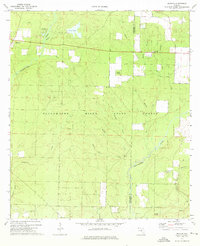
The Blackwater River State Forest dominates this landscape in northern Santa Rosa County, where a dense network of creek branches and spring-fed streams flows toward the Blackwater River. The settlement of Munson serves as a local hub near the Munson Recreation Area, while rural life is centered around landmarks like Ates Cem and Good Hope Ch. This mid-century survey reveals a transition from managed timberlands and recreational spaces, such as Bear Lake, to the intricate drainage basins of Sweetwater Creek and Lighter Knot Creek. Genealogists will find interest in the scattered rural locations like New Bethany Ch and the county line shared by Santa Rosa Co and Okaloosa Co, showing how community life and natural watercourses defined the region's early development patterns.
Find a feature on this map
28 named features on this map. Tap any name to fly to it.
Don’t see what you’re looking for? This feature index may not catch every label — zoom into the map to look around manually.
Map Details
Editions of this 1973 Munson Map
3 editions found

Other maps of this area

1934 · Holt
USGS Topo · 1:48,000
1934 · Harold
USGS Topo · 1:62,500

1937 · Holt
USGS Topo · 1:62,500
1937 · Harold
USGS Topo · 1:62,500
1938 · Harold
USGS Topo · 1:62,500
1948 · Munson
USGS Topo · 1:62,500
1949 · Crestview
USGS Topo · 1:62,500
1950 · Munson
USGS Topo · 1:62,500
1951 · Crestview
USGS Topo · 1:62,500
1956 · Holt
USGS Topo · 1:62,500