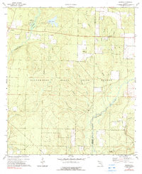
1973 Map of Munson
USGS Topo · Published 1990About this map
The settlement of Munson serves as the primary hub in this portion of the Florida Panhandle, situated within the expansive Blackwater River State Forest. Surveyed in the early 1970s, the landscape is defined by the winding course of the Blackwater River and a dense network of tributaries including Blue Creek, Ates Creek, and Alligator Creek. This era of the forest's history is reflected in the established Munson Recreation Area and the Campsite at Bear Lake, indicating the region's importance for public conservation and local recreation.
Find a feature on this map
30 named features on this map. Tap any name to fly to it.
Don’t see what you’re looking for? This feature index may not catch every label — zoom into the map to look around manually.
Map Details
Editions of this 1973 Munson Map
3 editions found
Other maps of this area

1934 · Holt
USGS Topo · 1:48,000

1934 · Harold
USGS Topo · 1:62,500

1937 · Holt
USGS Topo · 1:62,500

1937 · Harold
USGS Topo · 1:62,500

1938 · Harold
USGS Topo · 1:62,500

1948 · Munson
USGS Topo · 1:62,500

1949 · Crestview
USGS Topo · 1:62,500

1950 · Munson
USGS Topo · 1:62,500

1951 · Crestview
USGS Topo · 1:62,500

1956 · Holt
USGS Topo · 1:62,500