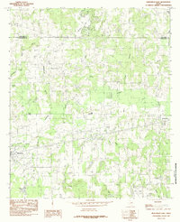
1984 Map of Murchison East
USGS Topo · Published 1984About this map
Murchison and Brownsboro anchor this East Texas landscape at the boundary of Van Zandt Co and Henderson Co. The area is defined by its extensive network of water bodies, including Callender Lake in the north and the smaller Echo Lake, Chapman Lake, and Echols Lake to the south. A notable industrial presence is marked by a Refinery near Opelika, situated amongst a dense web of seasonal creeks and branches. The hydrology of the region is complex, with Kickapoo Creek and Big Sandy Creek drawing from numerous tributaries like Killingsworth Branch and Bailey Branch. This 1980s-era documentation provides a clear view of the rural road network and dispersed homesteads that characterize the timber and oil-influenced terrain of this part of Texas.
Find a feature on this map
25 named features on this map. Tap any name to fly to it.
Don’t see what you’re looking for? This feature index may not catch every label — zoom into the map to look around manually.
Map Details
Editions of this 1984 Murchison East Map
This is the sole edition of this map. No revisions or reprints were ever made.
Other maps of this area

1948 · Brownsboro
USGS Topo · 1:62,500

1948 · Martins Mill
USGS Topo · 1:62,500

1949 · Martins Mill
USGS Topo · 1:62,500

1949 · Brownsboro
USGS Topo · 1:62,500

1949 · Frankston
USGS Topo · 1:62,500

1949 · Athens
USGS Topo · 1:62,500

1950 · Athens
USGS Topo · 1:62,500

1950 · Frankston
USGS Topo · 1:62,500

1956 · Tyler
USGS Topo · 1:250,000

1984 · Tyler
USGS Topo · 1:250,000