
1956 Map of Murdock NW
USGS Topo · Published 1957About this map
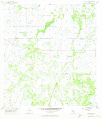
Myakka River State Park dominates the northern reaches of this mid-century landscape, preserving a vast network of wetlands and seasonal waterways along the Manatee and Sarasota County line. The hydrology of the region is defined by winding natural drainages like Deer Prairie Slough and Mossy Island Slough, which are contrasted by the straight, engineered path of the Big Slough Canal. This juxtaposition illustrates early Florida water management efforts designed to reclaim the surrounding prairie for other uses. Traceable remnants of earlier transportation infrastructure appear as the Old Railroad Grade, cutting through the park and across the open wetlands. Several instances of a Flowing Well are marked across the terrain, indicating the subterranean water resources that supported cattle or early land development in this intermittently flooded environment.
Find a feature on this map
9 named features on this map. Tap any name to fly to it.
Don’t see what you’re looking for? This feature index may not catch every label — zoom into the map to look around manually.
Map Details
Editions of this 1956 Murdock NW Map
3 editions found
Other maps of this area

1944 · Lower Myakka Lake
USGS Topo · 1:31,680

1944 · Myakka River
USGS Topo · 1:31,680

1944 · Miakka
USGS Topo · 1:31,680

1956 · Murdock
USGS Topo · 1:24,000

1956 · Myakka City
USGS Topo · 1:24,000

1956 · Edgeville
USGS Topo · 1:24,000

1956 · Murdock SE
USGS Topo · 1:24,000

1956 · Murdock NE
USGS Topo · 1:24,000

1956 · Tampa
USGS Topo · 1:250,000

1959 · Tampa
USGS Topo · 1:250,000