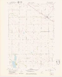
1958 Map of Murdock
USGS Topo · Published 1980About this map
The small prairie town of Murdock serves as the focal point of this late 1950s survey, situated along the Great Northern railroad line. The landscape is a study in early mid-century rural planning, featuring a prominent Municipal Landing Strip and a series of township boundaries like Dublin, Kildare, and Louriston that reveal the organized settlement patterns of western Minnesota. Waterways such as Mud Creek and Shakopee Creek define the drainage of the agricultural terrain.
Find a feature on this map
17 named features on this map. Tap any name to fly to it.
Don’t see what you’re looking for? This feature index may not catch every label — zoom into the map to look around manually.
Map Details
Editions of this 1958 Murdock Map
3 editions found
Other maps of this area

1953 · Saint Cloud
USGS Topo · 1:250,000

1957 · Saint Cloud
USGS Topo · 1:250,000

1958 · Saint Cloud
USGS Topo · 1:250,000

1958 · Murdock
USGS Topo · 1:24,000

1958 · Gracelock NE
USGS Topo · 1:24,000

1958 · Kerkhoven SE
USGS Topo · 1:24,000

1958 · Kerkhoven
USGS Topo · 1:24,000

1958 · Kerkhoven SW
USGS Topo · 1:24,000

1958 · Gracelock
USGS Topo · 1:24,000

1968 · De Graff
USGS Topo · 1:24,000