Loading...
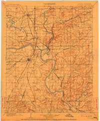
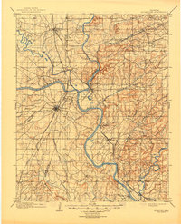
Loading map...1901 Map of Muskogee
USGS Topo · Published 1910About this map
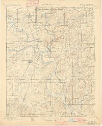
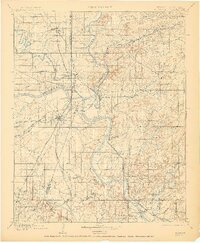
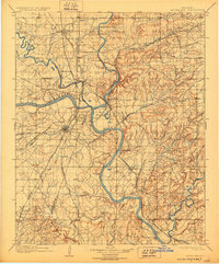
The Arkansas River serves as the central artery for this 1890s survey of the Creek Nation Cherokee Nation boundary. The landscape is defined by the convergence of major waterways, including the Verdigris River and the Grand or Neosho River, which dictated early settlement patterns and transit. Before the era of modern bridges, a complex network of river crossings supported the local economy, ranging from Mingo Ferry in the northwest to Tenkillers Ferry in the southeast.
Find a feature on this map
58 named features on this map. Tap any name to fly to it.
Don’t see what you’re looking for? This feature index may not catch every label — zoom into the map to look around manually.
Map Details
Date Portrayed1901
Date Published1910
PublisherU.S. Geological Survey
Map TypeTopographic
Scale1:125,000
Physical Dimensions16.5 x 19.9 inches
Editions of this 1901 Muskogee Map
6 editions found

Historical Maps of Muskogee Through Time

Featured Locations
Source Details
SourceU.S. Geological Survey
CopyrightPublic Domain