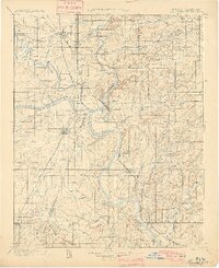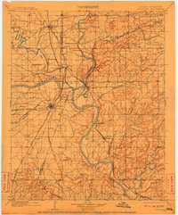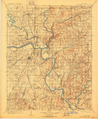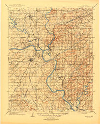
1901 Map of Muskogee
USGS Topo · Published 1910About this map
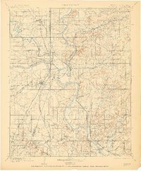
The Arkansas River serves as the central artery of this Indian Territory survey, joined by the Verdigris River, Neosho River, and Illinois River in a complex aquatic network. This confluence at Fort Gibson defines the region's historical importance as a transit hub, evidenced by the numerous river crossings such as Frenchs Upper Ferry, Harris Ferry, and Tenkillers Ferry. The map documents a critical moment in the transition from tribal lands to statehood, clearly marking the Creek Nation Cherokee Nation boundary line. In Muskogee, a burgeoning rail-and-river economy is visible through the convergence of major lines like the Missouri Kansas and Texas R. R. and the Midland Valley R. R.. Beyond the urban centers, landmarks like the Seminary near Crittenden and the Mission west of Muskogee point to the established social and educational infrastructure of the territory at the turn of the century.
Find a feature on this map
60 named features on this map. Tap any name to fly to it.
Don’t see what you’re looking for? This feature index may not catch every label — zoom into the map to look around manually.
Map Details
Editions of this 1901 Muskogee Map
6 editions found