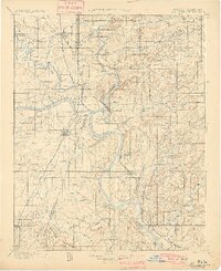
1901 Map of Muskogee
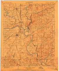
USGS Topo · Published 1945About this map
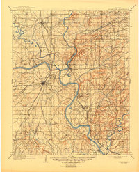
Fort Gibson stands at the confluence of the Grand River, Verdigris River, and Arkansas River, anchoring a landscape defined by water and rail transport before Oklahoma statehood. This territory, divided between the Creek Nation and Cherokee Nation, shows a complex network of river crossings including Mingo Ferry, French's Upper Ferry, and the descriptively named Whisky Ford. The rail hub of Muskogee is already emerging as a significant junction for the Missouri Kansas and Texas R. R. and the St. Louis and San Francisco R. R., while smaller settlements like Tullahassee and Wagoner follow the tracks. The presence of a Mission near the Midland Valley R. R. and the Rattlesnake Mountains to the south illustrate the diverse topography and social infrastructure of Indian Territory at the close of the 19th century.
Find a feature on this map
61 named features on this map. Tap any name to fly to it.
Don’t see what you’re looking for? This feature index may not catch every label — zoom into the map to look around manually.
Map Details
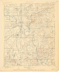
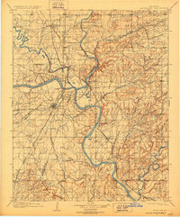
Editions of this 1901 Muskogee Map
6 editions found