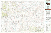
1993 Map of Musselshell
USGS Topo · Published 1993About this map
Winnett and the broad valley of Flatwillow Creek anchor this central Montana landscape, where the transition from the Little Snowy Mountains to the expansive Devils Basin defines the local geography. The map documents a complex water management and conservation network, featuring the Lake Mason National Wildlife Refuge and the War Horse National Wildlife Refuge. These areas, alongside numerous reservoirs like Petrolia Lake and Yellow Water Reservoir, reflect the importance of water storage in this semi-arid environment. Along the southern edge, the Musselshell River flows past the settlements of Musselshell and Delphia, accompanied by the Musselshell Ditch irrigation system. Industrial activity is represented by the Melstone Oil Field and the Little Wall Pumping Sta, highlighting the region's reliance on both natural resources and hydraulic infrastructure for its economic survival.
Find a feature on this map
57 named features on this map. Tap any name to fly to it.
Don’t see what you’re looking for? This feature index may not catch every label — zoom into the map to look around manually.
Map Details
Editions of this 1993 Musselshell Map
This is the sole edition of this map. No revisions or reprints were ever made.
Other maps of this area

1889 · Big Snowy Mountain
USGS Topo · 1:250,000

1893 · Big Snowy Mountain
USGS Topo · 1:250,000

1941 · Judith Peak
USGS Topo · 1:62,500

1944 · Judith Peak
USGS Topo · 1:62,500

1954 · Jordan
USGS Topo · 1:250,000

1954 · Forsyth
USGS Topo · 1:250,000

1954 · Roundup
USGS Topo · 1:250,000

1954 · Lewistown
USGS Topo · 1:250,000

1956 · Jordan
USGS Topo · 1:250,000

1957 · Forsyth
USGS Topo · 1:250,000