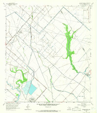
1963 Map of Mustang Bayou
USGS Topo · Published 1966About this map
Mustang Bayou and Halls Bayou wind through this coastal Texas landscape, defining a region where agricultural drainage canals meet the heavy infrastructure of the mid-century energy industry. The map illustrates the convergence of water and commerce, with the Missouri Pacific railroad cutting diagonally across the terrain, parallel to the Chocolate Bayou Oil Field and the Alta Loma Oil Field. While much of the land is crisscrossed by pipelines and canals like the Rice Road and Briscoe Road, small markers of local history remain, such as the German Cem and the small cluster at Halls Bayou Camp. Large-scale industrial footprints are visible at the Refinery and Chemical Plant, highlighting the intensive resource extraction that shaped Brazoria and Galveston counties during the 1960s.
Find a feature on this map
27 named features on this map. Tap any name to fly to it.
Don’t see what you’re looking for? This feature index may not catch every label — zoom into the map to look around manually.
Map Details
Editions of this 1963 Mustang Bayou Map
3 editions found
Other maps of this area

1929 · Dickinson
USGS Topo · 1:24,000

1929 · Karankawa Lake
USGS Topo · 1:24,000

1929 · Algoa
USGS Topo · 1:24,000

1929 · Hitchcock
USGS Topo · 1:24,000

1932 · Algoa
USGS Topo · 1:31,680

1932 · Dickinson
USGS Topo · 1:31,680

1932 · Hitchcock
USGS Topo · 1:31,680

1932 · Mustang Bayou
USGS Topo · 1:31,680

1933 · Karankawa Lake
USGS Topo · 1:31,680

1943 · Danbury
USGS Topo · 1:31,680