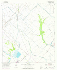
1963 Map of Mustang Bayou
USGS Topo · Published 1977About this map
Industrial expansion and coastal hydrology define this portion of the Texas Gulf Coast as it transitioned through the mid-20th century. The Alta Loma Oil Field and the Chocolate Bayou Oil Field dominate the landscape, marked by a dense network of drill holes, gas wells, and pipelines that underscore the region's petroleum economy. These energy assets are supported by heavy infrastructure, including a refinery, a large chemical plant, and several pumping stations that line the corridors of the Missouri Pacific railroad.
Find a feature on this map
27 named features on this map. Tap any name to fly to it.
Don’t see what you’re looking for? This feature index may not catch every label — zoom into the map to look around manually.
Map Details
Editions of this 1963 Mustang Bayou Map
3 editions found
Other maps of this area

1929 · Dickinson
USGS Topo · 1:24,000

1929 · Karankawa Lake
USGS Topo · 1:24,000

1929 · Algoa
USGS Topo · 1:24,000

1929 · Hitchcock
USGS Topo · 1:24,000

1932 · Algoa
USGS Topo · 1:31,680

1932 · Dickinson
USGS Topo · 1:31,680

1932 · Hitchcock
USGS Topo · 1:31,680

1932 · Mustang Bayou
USGS Topo · 1:31,680

1933 · Karankawa Lake
USGS Topo · 1:31,680

1943 · Danbury
USGS Topo · 1:31,680