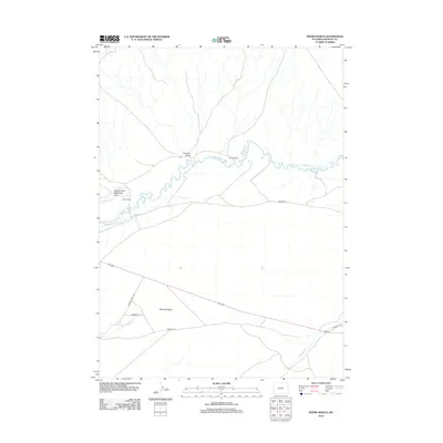
2012 Map of Myers Ranch
USGS Topo · Published 2012About this map
The Sweetwater River winds through this high-desert landscape in Fremont County, where historic Western migration routes intersect with modern ranching life. The most significant historical marker is the legendary Oregon Trl, which traverses the southern portion of the map, passing near the wide Sweeney Basin. This corridor has served as a vital passage for generations, defined by distinct water features like Ice Slough and Warm Springs Cr.
Find a feature on this map
14 named features on this map. Tap any name to fly to it.
Don’t see what you’re looking for? This feature index may not catch every label — zoom into the map to look around manually.
Map Details
Editions of this 2012 Myers Ranch Map
This is the sole edition of this map. No revisions or reprints were ever made.
Other maps of this area

1951 · Soap Holes
USGS Topo · 1:24,000

1951 · Graham Ranch
USGS Topo · 1:24,000

1951 · Crooks Mountain
USGS Topo · 1:24,000

1951 · Myers Ranch
USGS Topo · 1:24,000

1952 · Tin Cup Mountain
USGS Topo · 1:24,000

1953 · Sweetwater Station
USGS Topo · 1:24,000

1953 · Happy Spring
USGS Topo · 1:24,000

1953 · Elkhorn Springs
USGS Topo · 1:24,000

1953 · Dishpan Butte
USGS Topo · 1:24,000

1955 · Lander
USGS Topo · 1:250,000