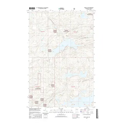
2016 Map of Myrtle Lake
USGS Topo · Published 2016About this map
Superior National Forest defines the character of this northern landscape, where the Pelican River and Elbow River wind through a dense network of water bodies and marshlands. Modern recreational routes like the Arrowhead Snowmobile Trail navigate the terrain, connecting significant waters such as Myrtle Lake and Ban Lake. The survey highlights a region shaped by its hydrology, where local transit is facilitated by routes like Orr Buyck Rd and Co Rd 23, providing access to the more isolated areas near Little Elbow Lake and the distinctive elevation of Wolf Knoll. This area remains largely defined by its conservation status and the natural flow of its river systems, offering a detailed look at the interface between managed forest lands and the glacial lake systems of Saint Louis County.
Find a feature on this map
21 named features on this map. Tap any name to fly to it.
Don’t see what you’re looking for? This feature index may not catch every label — zoom into the map to look around manually.
Map Details
Editions of this 2016 Myrtle Lake Map
This is the sole edition of this map. No revisions or reprints were ever made.
Other maps of this area

1954 · Hibbing
USGS Topo · 1:250,000

1954 · International Falls
USGS Topo · 1:250,000

1957 · Hibbing
USGS Topo · 1:250,000

1957 · International Falls
USGS Topo · 1:250,000

1958 · International Falls
USGS Topo · 1:250,000

1958 · Hibbing
USGS Topo · 1:250,000

1964 · Hibbing
USGS Topo · 1:250,000

1964 · Haley
USGS Topo · 1:24,000

1964 · Gheen
USGS Topo · 1:24,000
1964 · Norwegian Bay
USGS Topo · 1:24,000