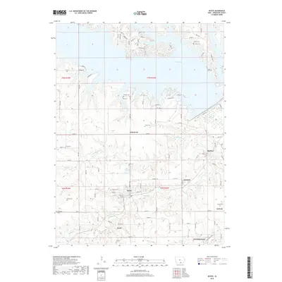
2018 Map of Mystic
USGS Topo · Published 2018About this map
Mystic and the northern reaches of Centerville anchor this detailed study of Appanoose County's undulating landscape. The map centers on the winding course of Walnut Creek and Little Walnut Creek, which feed into the expansive waters of Rathbun Lake to the north. This area reflects a dense pattern of early rural settlement, characterized by numerous small communities and family-associated landmarks. Small villages like Brazil, Clarkdale, and Rathbun are connected by a network of local roads such as Co Rd T14 and Shanghi Road.
Find a feature on this map
101 named features on this map. Tap any name to fly to it.
Don’t see what you’re looking for? This feature index may not catch every label — zoom into the map to look around manually.
Map Details
Editions of this 2018 Mystic Map
This is the sole edition of this map. No revisions or reprints were ever made.
Other maps of this area

1935 · Russell
USGS Topo · 1:62,500

1938 · Russell
USGS Topo · 1:62,500

1939 · Centerville
USGS Topo · 1:62,500

1939 · Mystic
USGS Topo · 1:62,500

1941 · Centerville
USGS Topo · 1:62,500

1942 · Mystic
USGS Topo · 1:62,500

1942 · Seymour
USGS Topo · 1:62,500

1944 · Seymour
USGS Topo · 1:62,500

1954 · Centerville
USGS Topo · 1:250,000

1957 · Centerville
USGS Topo · 1:250,000