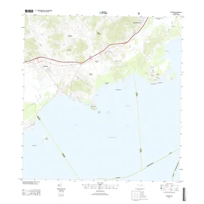
2013 Map of Naguabo
USGS Topo · Published 2013About this map
Naguabo and the inland settlement of Aguas Claras anchor this coastal landscape where the foothills of the Island of Puerto Rico meet the Caribbean Sea. The geography is defined by a dense network of watercourses, including the Río Blanco and Río Santiago, which flow toward the Puerto de Naguabo. The maritime character of the region is evident in the numerous coastal features such as Bahía Algodones and the protective Arrecife Lima.
Find a feature on this map
60 named features on this map. Tap any name to fly to it.
Don’t see what you’re looking for? This feature index may not catch every label — zoom into the map to look around manually.
Map Details
Editions of this 2013 Naguabo Map
This is the sole edition of this map. No revisions or reprints were ever made.
Other maps of this area

1945 · El Yunque
USGS Topo · 1:30,000

1946 · El Yunque
USGS Topo · 1:30,000

1946 · Humacao
USGS Topo · 1:30,000

1946 · Punta Guayanes
USGS Topo · 1:30,000

1946 · Punta Puerca
USGS Topo · 1:30,000

1946 · Naguabo
USGS Topo · 1:30,000
1947 · Punta Guayanes NE
USGS Topo · 1:10,000
1947 · Humacao SE
USGS Topo · 1:10,000

1947 · El Yunque SE
USGS Topo · 1:10,000
1947 · Humacao NE
USGS Topo · 1:10,000