Loading...
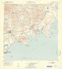
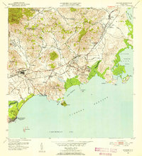
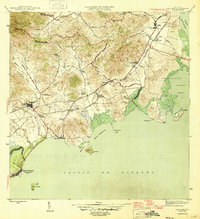
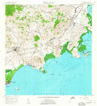
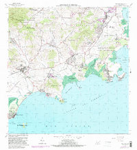
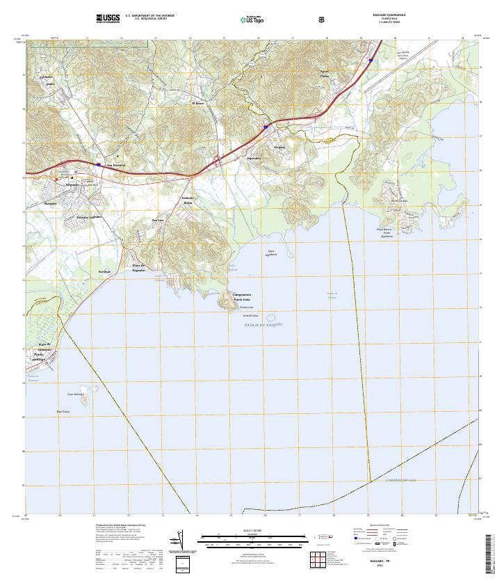
Loading map...1952 Map of Naguabo
USGS Topo · Published 1953About this map
Sugar cane cultivation and coastal defense define the landscape of eastern Puerto Rico in the early 1950s. The region is marked by an extensive infrastructure of agricultural colonies like Colonia Aguas Claras and Colonia El Banco, many of which were serviced by the narrow-gauge industrial lines of the Fajardo Development Co and the Ferrocarril del Este. These rail networks converge near the Estacion Naguabo, illustrating the era's reliance on rail for transporting cane to local centrals.
Find a feature on this map
71 named features on this map. Tap any name to fly to it.
Don’t see what you’re looking for? This feature index may not catch every label — zoom into the map to look around manually.
Map Details
Date Portrayed1952
Date Published1953
PublisherU.S. Geological Survey
Map TypeTopographic
Scale1:30,000
Physical Dimensions19.95 x 22.12 inches
Editions of this 1952 Naguabo Map
2 editions found
Historical Maps of Ceiba Through Time
7 maps found
Featured Locations
Source Details
SourceU.S. Geological Survey
CopyrightPublic Domain