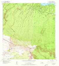
1957 Map of Nahiku
USGS Topo · Published 1972About this map
The coastal settlement of Nahiku and the surrounding agricultural allotments of the Nahiku Homesteads define this 1957 survey of Maui's windward coast. The landscape is characterized by a sophisticated water management network, where the Koolau Ditch and various pipelines traverse deep gulches like Waihole Gulch to capture the heavy rainfall from the Koolau Forest Reserve. Numerous gaging stations along streams such as Kopiliula Stream and Wailuaiki Stream reflect the era's focus on monitoring these vital water resources for downstream use.
Find a feature on this map
71 named features on this map. Tap any name to fly to it.
Don’t see what you’re looking for? This feature index may not catch every label — zoom into the map to look around manually.
Map Details
Editions of this 1957 Nahiku Map
2 editions found
Other maps of this area

1954 · Maui
USGS Topo · 1:250,000

1957 · Kilohana
USGS Topo · 1:24,000

1957 · Kipahulu
USGS Topo · 1:24,000

1957 · Hana
USGS Topo · 1:24,000

1957 · Haiku
USGS Topo · 1:24,000

1957 · Lualailua Hills
USGS Topo · 1:24,000

1957 · Nahiku
USGS Topo · 1:24,000

1957 · Kaupo
USGS Topo · 1:24,000

1957 · Keanae
USGS Topo · 1:24,000

1966 · Maui
USGS Topo · 1:250,000