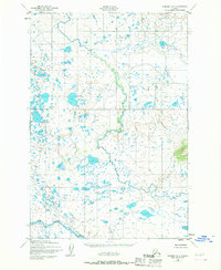
1952 Map of Naknek B-2
USGS Topo · Published 1967About this map
King Salmon River meanders across the southern portion of this landscape, its complex oxbows and surrounding marshlands defining the lower drainage patterns of the Bristol Bay region. The terrain is characterized by a dense concentration of small lakes and ponds, typical of the glacial and alluvial history found on the Alaska Peninsula. Mapped through aerial photography by the Army Map Service in the early 1950s, the map reveals a wilderness area entirely devoid of roads or permanent trails at the time of the survey. The intricate network of wetlands surrounding the river suggests a landscape dominated by seasonal hydrologic shifts, where the geography was shaped more by the movement of water and salmon than by human settlement or infrastructure.
Find a feature on this map
1 named feature on this map. Tap any name to fly to it.
Don’t see what you’re looking for? This feature index may not catch every label — zoom into the map to look around manually.
Map Details
Editions of this 1952 Naknek B-2 Map
2 editions found
Other maps of this area

1951 · Naknek B-1
USGS Topo · 1:63,360

1951 · Naknek C-1
USGS Topo · 1:63,360

1951 · Naknek A-2
USGS Topo · 1:63,360

1951 · Naknek A-1
USGS Topo · 1:63,360

1951 · Naknek A-3
USGS Topo · 1:63,360

1952 · Naknek
USGS Topo · 1:250,000

1952 · Naknek B-3
USGS Topo · 1:63,360

1952 · Naknek B-2
USGS Topo · 1:63,360

1952 · Naknek C-2
USGS Topo · 1:63,360

1952 · Naknek C-3
USGS Topo · 1:63,360