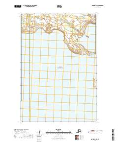
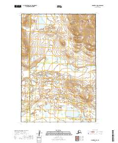
2019 Map of Naknek C-1 NW
USGS Topo · Published 2019About this map
Katmai National Park dominates this landscape, encompassing the vast majority of the territory mapped here. The wilderness is defined by the northern reaches of Naknek Lake, where the shoreline transitions from the deep waters of the lake into the complex drainage systems of the interior. The map illustrates the administrative boundary between the Lake and Peninsula Borough and the Bristol Bay Borough, a line that cuts through the remote terrain west of the park. The topography is marked by significant elevation changes near the lake's edge, highlighting the transition from the low-lying basin to the surrounding uplands. This 2019 data reflects a region where natural boundaries and federal protections dictate the land use, showing a pristine environment largely devoid of human infrastructure.
Find a feature on this map
9 named features on this map. Tap any name to fly to it.
Don’t see what you’re looking for? This feature index may not catch every label — zoom into the map to look around manually.
Map Details
Editions of this 2019 Naknek C-1 NW Map
This is the sole edition of this map. No revisions or reprints were ever made.
Other maps of this area

1951 · Naknek D-1
USGS Topo · 1:63,360

1951 · Naknek C-1
USGS Topo · 1:63,360

1952 · Naknek
USGS Topo · 1:250,000

1952 · Naknek D-2
USGS Topo · 1:63,360

1952 · Naknek C-2
USGS Topo · 1:63,360

1964 · Naknek
USGS Topo · 1:250,000
2019 · Naknek D-2 SE
USGS Topo · 1:25,000
2019 · Naknek C-2 SE
USGS Topo · 1:25,000
2019 · Naknek C-1 NE
USGS Topo · 1:25,000
2019 · Naknek D-1 SW
USGS Topo · 1:25,000