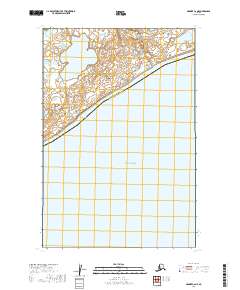
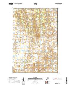
2019 Map of Naknek C-6 NE
USGS Topo · Published 2019About this map
Kvichak Bay dominates the southern reaches of this landscape, where the tides of the Bristol Bay region meet the southwestern Alaskan coast. The map illustrates a transitional hydrologic environment where freshwater systems like Supply Lake and its outlet, Supply Cr, move toward the salt water. A distinct landform, Lake Point, projects into the bay, marking the divide between the inland tundra lakes and the coastal waters. This coastal boundary also serves as a political line, separating the Dillingham Census Area and Bristol Bay Borough. The terrain is characterized by low-lying wetlands and subtle elevation changes, typical of the depositional environments found along the Naknek coastline.
Find a feature on this map
9 named features on this map. Tap any name to fly to it.
Don’t see what you’re looking for? This feature index may not catch every label — zoom into the map to look around manually.
Map Details
Editions of this 2019 Naknek C-6 NE Map
This is the sole edition of this map. No revisions or reprints were ever made.
Other maps of this area

1952 · Naknek
USGS Topo · 1:250,000

1952 · Naknek C-5
USGS Topo · 1:63,360

1952 · Naknek C-6
USGS Topo · 1:63,360

1952 · Naknek D-5
USGS Topo · 1:63,360

1952 · Naknek D-6
USGS Topo · 1:63,360

1964 · Naknek
USGS Topo · 1:250,000
2019 · Naknek C-6 NW
USGS Topo · 1:25,000
2019 · Naknek D-5 SW
USGS Topo · 1:25,000
2019 · Naknek C-5 NW
USGS Topo · 1:25,000
2019 · Naknek D-6 SE
USGS Topo · 1:25,000