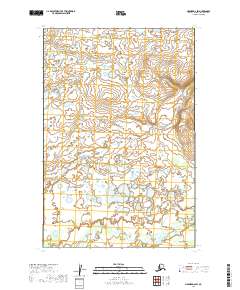
2019 Map of Naknek D-2 SW
USGS Topo · Published 2019About this map
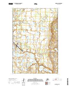
King Salmon anchors the southeastern corner of this landscape in the Bristol Bay region, where the terrain is defined by a dense network of wetlands and tundra ponds. The hydrology of the area is dominated by the winding paths of King Salmon Creek and Pauls Creek, which snake through the low-lying coastal plains. To the northwest, Graveyard Creek cuts through the surveyed townships of t15s r44w, illustrating the transition from open water to the complex drainage systems typical of this part of Alaska. This 2019 survey provides a precise record of the shifting water margins and seasonal drainage patterns that shape local subsistence and navigation.
Find a feature on this map
8 named features on this map. Tap any name to fly to it.
Don’t see what you’re looking for? This feature index may not catch every label — zoom into the map to look around manually.
Map Details
Editions of this 2019 Naknek D-2 SW Map
This is the sole edition of this map. No revisions or reprints were ever made.
Other maps of this area

1952 · Naknek
USGS Topo · 1:250,000

1952 · Naknek D-2
USGS Topo · 1:63,360

1952 · Naknek C-2
USGS Topo · 1:63,360

1952 · Naknek C-3
USGS Topo · 1:63,360

1952 · Naknek D-3
USGS Topo · 1:63,360

1964 · Naknek
USGS Topo · 1:250,000
2019 · Naknek D-2 SE
USGS Topo · 1:25,000
2019 · Naknek D-2 NW
USGS Topo · 1:25,000
2019 · Naknek C-3 NE
USGS Topo · 1:25,000
2019 · Naknek C-2 NW
USGS Topo · 1:25,000