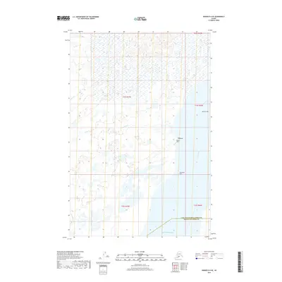
2019 Map of Naknek D-4 NE
USGS Topo · Published 2019About this map
Nakeen serves as a central point of interest on the eastern shore of the Kvichak Bay, a critical area for Bristol Bay's maritime and aviation geography. This coastal region is defined by the massive confluence of the Kvichak River and the bay, where the landscape transitions into tidal environments like Sea Gull Flat. Transportation and communication infrastructure are represented by the Nakeen Airport and the coastal landmark of Telephone Point. Further inland, the terrain is woven with a complex network of wetlands and small waterways, including Squaw Cr, Duck Cr, and King Salmon Cr. The map also delineates the administrative boundary between the Lake and Peninsula Borough and Bristol Bay Borough, illustrating how political lines bisect this remote coastal wilderness.
Find a feature on this map
15 named features on this map. Tap any name to fly to it.
Don’t see what you’re looking for? This feature index may not catch every label — zoom into the map to look around manually.
Map Details
Editions of this 2019 Naknek D-4 NE Map
This is the sole edition of this map. No revisions or reprints were ever made.
Other maps of this area

1951 · Dillingham
USGS Topo · 1:250,000

1952 · Naknek
USGS Topo · 1:250,000

1952 · Dillingham A-4
USGS Topo · 1:63,360

1952 · Dillingham A-3
USGS Topo · 1:63,360

1952 · Naknek D-3
USGS Topo · 1:63,360

1952 · Naknek D-4
USGS Topo · 1:63,360

1954 · Dillingham
USGS Topo · 1:250,000

1964 · Naknek
USGS Topo · 1:250,000
2019 · Naknek D-3 NW
USGS Topo · 1:25,000
2019 · Naknek D-4 SE
USGS Topo · 1:25,000