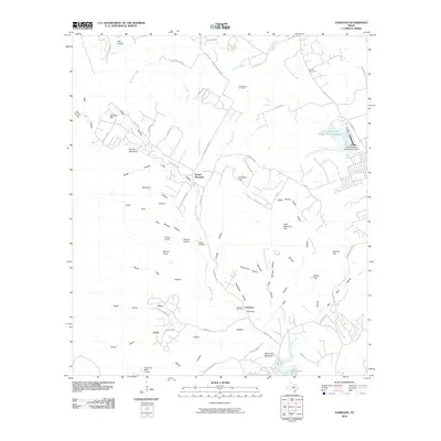
2010 Map of Nameless
USGS Topo · Published 2010About this map
Nameless sits at the heart of this Central Texas landscape, where the Balcones Escarpment's influence is evident in the dense network of drainage systems like Big Sandy Creek and North Fork Brushy Creek. The area is characterized by a high concentration of hollows, including Buttermilk Hollow, Bloody Hollow, and Honeycombe Hollow, which carve through the limestone terrain toward the southern reaches of Lake Travis. This 2010 survey shows a transition in land use, where established homesteads and family burial grounds like Fairview Cemetery and Huddleston Cemetery exist alongside modern aviation facilities such as the Lago Vista Bar-K Airpark. Local elevations like Polecat Knob and White Rim Mountain provide distinct vertical relief in a region where water management is critical, as seen at the Soil Conservation Service Site 1 Dam and its associated reservoir.
Find a feature on this map
77 named features on this map. Tap any name to fly to it.
Don’t see what you’re looking for? This feature index may not catch every label — zoom into the map to look around manually.
Map Details
Editions of this 2010 Nameless Map
This is the sole edition of this map. No revisions or reprints were ever made.
Other maps of this area

1887 · Blanco
USGS Topo · 1:125,000

1887 · Burnet
USGS Topo · 1:125,000

1893 · Georgetown
USGS Topo · 1:125,000

1893 · Burnet
USGS Topo · 1:125,000

1894 · Blanco
USGS Topo · 1:125,000

1896 · Austin
USGS Topo · 1:125,000

1897 · Austin
USGS Topo · 1:125,000

1903 · Burnet
USGS Topo · 1:125,000

1909 · Burnet
USGS Topo · 1:125,000

1910 · Austin
USGS Topo · 1:125,000