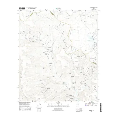
2016 Map of Nameless
USGS Topo · Published 2016About this map
Leander and Jonestown anchor this 2016 study of the Edwards Plateau foothills, where the Williamson and Travis county lines meet amidst a landscape of deeply cut drainages and high points. The terrain is defined by its numerous named hollows, such as Snake Hollow, Dewberry Hollow, and South Cherry Hollow, which funnel into major watercourses like Big Sandy Creek and the North Fork Brushy Creek. This modern survey reveals the suburban expansion of the Greater Austin area pushing into the hill country, yet preserves the location of many early pioneer burial grounds including Cedar Grove Cemetery, Miller Cemetery, and Huddleston Cemetery. To the south, the map captures the northern reaches of Lake Travis at the Sandy Creek Arm, positioned near the Lago Vista TX - Rusty Allen Airport, illustrating the region's shift toward recreation and aviation infrastructure.
Find a feature on this map
168 named features on this map. Tap any name to fly to it.
Don’t see what you’re looking for? This feature index may not catch every label — zoom into the map to look around manually.
Map Details
Editions of this 2016 Nameless Map
This is the sole edition of this map. No revisions or reprints were ever made.
Other maps of this area

1887 · Blanco
USGS Topo · 1:125,000

1887 · Burnet
USGS Topo · 1:125,000

1893 · Georgetown
USGS Topo · 1:125,000

1893 · Burnet
USGS Topo · 1:125,000

1894 · Blanco
USGS Topo · 1:125,000

1896 · Austin
USGS Topo · 1:125,000

1897 · Austin
USGS Topo · 1:125,000

1903 · Burnet
USGS Topo · 1:125,000

1909 · Burnet
USGS Topo · 1:125,000

1910 · Austin
USGS Topo · 1:125,000