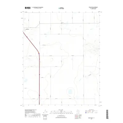
2019 Map of Nance Ranch
USGS Topo · Published 2019About this map
Canyon occupies the northwestern corner of this Randall County landscape, where the urban grid gives way to the expansive plains of the Texas Panhandle. The terrain is defined by the incision of drainage systems like Timber Cr, Sunday Cr, and N Cita Cr, which cut through the high plains toward the east. These intermittent watercourses, along with Corral Draw, create localized relief in an otherwise level environment dominated by a systematic grid of section roads.
Find a feature on this map
26 named features on this map. Tap any name to fly to it.
Don’t see what you’re looking for? This feature index may not catch every label — zoom into the map to look around manually.
Map Details
Editions of this 2019 Nance Ranch Map
This is the sole edition of this map. No revisions or reprints were ever made.
Other maps of this area

1954 · Amarillo
USGS Topo · 1:250,000

1954 · Plainview
USGS Topo · 1:250,000

1956 · Fortress Cliff
USGS Topo · 1:24,000

1956 · Thomas Ranch
USGS Topo · 1:24,000

1958 · Amarillo
USGS Topo · 1:250,000

1958 · Plainview
USGS Topo · 1:250,000

1960 · Canyon
USGS Topo · 1:62,500

1960 · The Palisades
USGS Topo · 1:24,000
1960 · Buffalo Stadium
USGS Topo · 1:24,000

1960 · Wayside
USGS Topo · 1:62,500