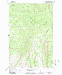
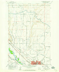
1966 Map of Naneum Canyon
USGS Topo · Published 1987About this map
Wenatchee National Forest and the Colockum State Wildlife Area dominate this section of the Kittitas high country, where the landscape is defined by the deep incisions of Naneum Canyon and Dawson Canyon. The map records a transition in land use during the mid-1960s, with updates into the 1980s, showing a network of remote jeep trails and drainage-oriented topography. High alpine basins such as the Naneum Basin are punctuated by local landmarks like Walter Flat and Croker Flat. Water resources are central to the map's detail, featuring numerous named springs like Leonard Spring and Gustafson Spring, alongside the critical infrastructure of a Gaging Station Filtration Plant along Wilson Creek. The presence of Cave Gulch and Burnt Canyon suggests a complex terrain that historically served as both a timber resource and a managed wildlife sanctuary.
Find a feature on this map
28 named features on this map. Tap any name to fly to it.
Don’t see what you’re looking for? This feature index may not catch every label — zoom into the map to look around manually.
Map Details
Editions of this 1966 Naneum Canyon Map
4 editions found
Other maps of this area

1897 · Mount Stuart
USGS Topo · 1:125,000

1902 · Mount Stuart
USGS Topo · 1:125,000

1913 · Wenatchee
USGS Topo · 1:62,500

1915 · Wenatchee
USGS Topo · 1:62,500

1920 · Colockum Pass
USGS Topo · 1:125,000

1922 · Colockum Pass
USGS Topo · 1:125,000

1957 · Wenatchee
USGS Topo · 1:250,000

1958 · Thorp
USGS Topo · 1:62,500
1958 · Ellensburg North
USGS Topo · 1:24,000

1961 · Liberty
USGS Topo · 1:62,500