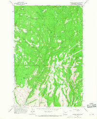
1966 Map of Naneum Canyon
USGS Topo · Published 1968About this map
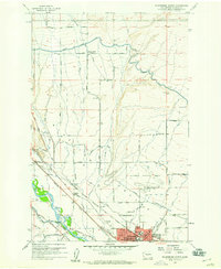
Wenatchee National Forest spans this mid-1960s survey, revealing a landscape defined by deep drainages and upland flats. The area is dominated by the complex convergence of Naneum Canyon, Dawson Canyon, and Coleman Canyon, which channel water from the high ridges toward the valley floor. Human infrastructure is primarily utilitarian and tied to the management of these natural resources, evidenced by the Gaging Station Filtration Plant and a network of primitive routes including the Nealey Pack Trail and several miles of Jeep Trail. Named water sources like Leonard Spring and Gustafson Spring mark critical points in the dry upland terrain of Croker Flat and Walter Flat. The mapping of a Private Road and a series of pack trails suggests an era when this portion of Kittitas County was managed for timber, grazing, and watershed protection before more modern recreational development.
Find a feature on this map
28 named features on this map. Tap any name to fly to it.
Don’t see what you’re looking for? This feature index may not catch every label — zoom into the map to look around manually.
Map Details
Editions of this 1966 Naneum Canyon Map
4 editions found
Other maps of this area

1897 · Mount Stuart
USGS Topo · 1:125,000

1902 · Mount Stuart
USGS Topo · 1:125,000

1913 · Wenatchee
USGS Topo · 1:62,500

1915 · Wenatchee
USGS Topo · 1:62,500

1920 · Colockum Pass
USGS Topo · 1:125,000

1922 · Colockum Pass
USGS Topo · 1:125,000

1957 · Wenatchee
USGS Topo · 1:250,000

1958 · Thorp
USGS Topo · 1:62,500
1958 · Ellensburg North
USGS Topo · 1:24,000

1961 · Liberty
USGS Topo · 1:62,500