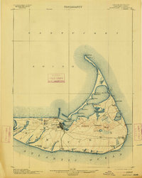
1901 Map of Nantucket
USGS Topo · Published 1913About this map
Nantucket island is captured here as a maritime and resort landscape in transition, anchored by the dense village at Nantucket Harbor. The interior reveals a complex network of coastal ponds and high ground, including the Altar Rock Hills and Folger Hill. A notable transport feature of the era is the Nantucket Central R. R., which connects the main harbor to the eastern village of Siasconset and runs south to Surfside.
Find a feature on this map
62 named features on this map. Tap any name to fly to it.
Don’t see what you’re looking for? This feature index may not catch every label — zoom into the map to look around manually.
Map Details
Editions of this 1901 Nantucket Map
5 editions found
Other maps of this area

1887 · Muskeget
USGS Topo · 1:62,500

1889 · Muskeget
USGS Topo · 1:62,500

1889 · Nantucket
USGS Topo · 1:62,500

1893 · Nantucket
USGS Topo · 1:62,500

1893 · Muskeget
USGS Topo · 1:62,500

1899 · Muskeget
USGS Topo · 1:62,500

1901 · Nantucket
USGS Topo · 1:62,500

1942 · Nantucket
USGS Topo · 1:125,000

1945 · Nantucket
USGS Topo · 1:31,680

1945 · Siasconset
USGS Topo · 1:31,680