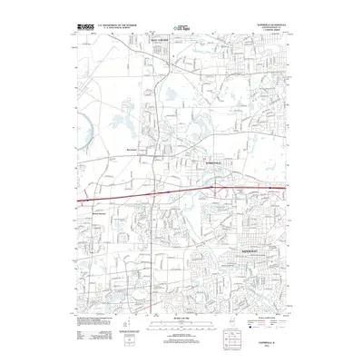
2012 Map of Naperville
USGS Topo · Published 2012About this map
The W Br Du Page River anchors this Illinois landscape, winding through a suburban corridor defined by rapid late-twentieth-century growth. In Naperville, the downtown core is clearly mapped near North Central College and the local landmark Centennial Beach. Significant institutional footprints dominate the western edge, most notably the Fermi National Accelerator Lab, while the Cantigny-War Memorial Museum occupies a large tract to the north. This survey illustrates the intricate residential expansion surrounding established centers like Warrenville and West Chicago, connected by a dense network of transit routes including Ferry Rd and Diehl Rd. For the local researcher, the map identifies several smaller settlements and transit points like Eola, Warrenhurst, and Batavia Junction, alongside several community burial grounds including Assumption Cem and the Saints Peter and Paul Cem.
Find a feature on this map
58 named features on this map. Tap any name to fly to it.
Don’t see what you’re looking for? This feature index may not catch every label — zoom into the map to look around manually.
Map Details
Editions of this 2012 Naperville Map
This is the sole edition of this map. No revisions or reprints were ever made.
Other maps of this area

1892 · Joliet
USGS Topo · 1:62,500

1908 · Wheaton
USGS Topo · 1:62,500

1923 · Joliet
USGS Topo · 1:62,500

1925 · Yorkville
USGS Topo · 1:62,500

1932 · Geneva
USGS Topo · 1:62,500

1948 · Wheaton
USGS Topo · 1:62,500

1948 · Geneva
USGS Topo · 1:62,500

1949 · Geneva
USGS Topo · 1:24,000

1950 · Aurora North
USGS Topo · 1:24,000

1953 · Naperville
USGS Topo · 1:24,000