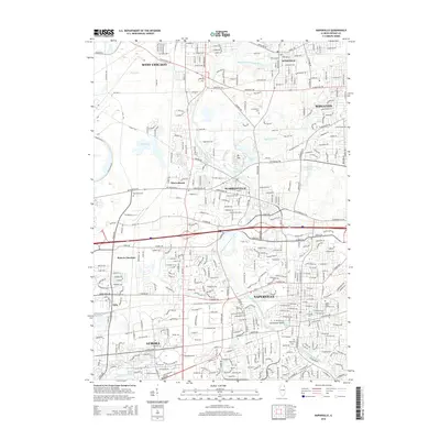
2015 Map of Naperville
USGS Topo · Published 2015About this map
The West Branch Du Page River defines the corridor of this suburban landscape, winding past the established centers of Naperville and Warrenville. This 2015 survey illustrates the dense residential and commercial expansion in the DuPage County region, while preserving significant local heritage sites. For genealogists and local historians, several burial grounds are detailed, including the Naperville Cem and the older Big Woods Cem west of Warrenville. The industrial and transport history of the area is represented by Batavia Junction and the active lines of the Burlington Northern Santa Fe railroad. Notable recreational and natural areas such as Herrick Lake and Centennial Beach are clearly marked, alongside the prominent elevation of Mt Hoy.
Find a feature on this map
151 named features on this map. Tap any name to fly to it.
Don’t see what you’re looking for? This feature index may not catch every label — zoom into the map to look around manually.
Map Details
Editions of this 2015 Naperville Map
This is the sole edition of this map. No revisions or reprints were ever made.
Other maps of this area

1892 · Joliet
USGS Topo · 1:62,500

1908 · Wheaton
USGS Topo · 1:62,500

1923 · Joliet
USGS Topo · 1:62,500

1925 · Yorkville
USGS Topo · 1:62,500

1932 · Geneva
USGS Topo · 1:62,500

1948 · Wheaton
USGS Topo · 1:62,500

1948 · Geneva
USGS Topo · 1:62,500

1949 · Geneva
USGS Topo · 1:24,000

1950 · Aurora North
USGS Topo · 1:24,000

1953 · Naperville
USGS Topo · 1:24,000