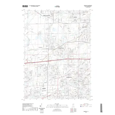
2021 Map of Naperville
USGS Topo · Published 2021About this map
The West Branch Du Page River meanders through a landscape of established communities and extensive recreational corridors in DuPage County. In Naperville, cultural and civic landmarks like North Central College and Centennial Beach define the suburban center, while the DuPage County Judicial Center marks the northern extent of Wheaton. Smaller settlements such as Eola and Warrenhurst represent the residential growth occurring between the larger hubs of Aurora and West Chicago. This modern topography is interspersed with significant natural preserves, including Herrick Lake and Herrick Lagoon. The conversion of former rail corridors is evident in the Illinois Prairie Path - Aurora Branch Trl, providing a continuous greenway that links Warrenville to the surrounding prairie landscape.
Find a feature on this map
42 named features on this map. Tap any name to fly to it.
Don’t see what you’re looking for? This feature index may not catch every label — zoom into the map to look around manually.
Map Details
Editions of this 2021 Naperville Map
This is the sole edition of this map. No revisions or reprints were ever made.
Other maps of this area

1892 · Joliet
USGS Topo · 1:62,500

1908 · Wheaton
USGS Topo · 1:62,500

1923 · Joliet
USGS Topo · 1:62,500

1925 · Yorkville
USGS Topo · 1:62,500

1932 · Geneva
USGS Topo · 1:62,500

1948 · Wheaton
USGS Topo · 1:62,500

1948 · Geneva
USGS Topo · 1:62,500

1949 · Geneva
USGS Topo · 1:24,000

1950 · Aurora North
USGS Topo · 1:24,000

1953 · Naperville
USGS Topo · 1:24,000