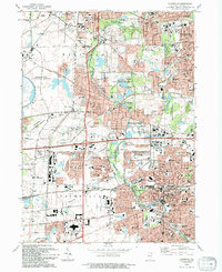
1993 Map of Naperville
USGS Topo · Published 1994About this map
Naperville and Warrenville define the suburban character of this DuPage County landscape, where rapid residential growth meets massive scientific and recreational footprints. The Fermi National Accelerator Laboratory occupies a significant portion of the western terrain, its distinct circular cooling ponds and research facilities standing in contrast to the dense street grids of Aurora to the southwest. Educational and institutional history is prominent, anchored by North Central College and its Athletic Complex, along with several regional campuses like the Illinois Youth Center Warrenville. The West Branch Du Page River and Spring Brook wind through a series of protected lands, including Blackwell County Forest Preserve and McDowell Grove County Forest Preserve, showing how natural corridors were maintained amidst the expanding commerce centered around the Fox Valley Mall and the East-West Tollway.
Find a feature on this map
93 named features on this map. Tap any name to fly to it.
Don’t see what you’re looking for? This feature index may not catch every label — zoom into the map to look around manually.
Map Details
Editions of this 1993 Naperville Map
This is the sole edition of this map. No revisions or reprints were ever made.
Other maps of this area

1892 · Joliet
USGS Topo · 1:62,500

1908 · Wheaton
USGS Topo · 1:62,500

1923 · Joliet
USGS Topo · 1:62,500

1925 · Yorkville
USGS Topo · 1:62,500

1932 · Geneva
USGS Topo · 1:62,500

1948 · Wheaton
USGS Topo · 1:62,500

1948 · Geneva
USGS Topo · 1:62,500

1949 · Geneva
USGS Topo · 1:24,000

1950 · Aurora North
USGS Topo · 1:24,000

1953 · Naperville
USGS Topo · 1:24,000