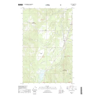
2020 Map of Naples
USGS Topo · Published 2020About this map
Naples and the surrounding timberlands of the Kaniksu National Forest are documented in this recent survey of northern Idaho. The landscape is defined by the mountain-shadowed corridor of Deep Creek, where the Union Pacific railroad and Old US Hwy 95 parallel the valley floor. Small residential clusters and agricultural holdings like Shiloh, Kootenai Orchard, and Paradise Valley appear alongside more remote mountain features such as Round Mtn and Ruby Ridge. The southern portion of the quadrangle is dominated by the McArthur Lake reservoir and several smaller alpine bodies of water, including Stampede Lake and Bradley Lake. This map provides clear detail on the modern road network, from established routes like Highland Flats Rd to named forest access roads like Saddle Back Summit and Roman Nose Lookout Rd.
Find a feature on this map
87 named features on this map. Tap any name to fly to it.
Don’t see what you’re looking for? This feature index may not catch every label — zoom into the map to look around manually.
Map Details
Editions of this 2020 Naples Map
This is the sole edition of this map. No revisions or reprints were ever made.
Other maps of this area

1901 · Sandpoint
USGS Topo · 1:125,000

1911 · Priest Lake
USGS Topo · 1:250,000

1911 · Sandpoint
USGS Topo · 1:125,000

1913 · Priest Lake
USGS Topo · 1:250,000

1951 · Elmira
USGS Topo · 1:62,500

1958 · Sandpoint
USGS Topo · 1:250,000

1963 · Sandpoint
USGS Topo · 1:250,000

1965 · Twentymile Creek
USGS Topo · 1:24,000

1965 · Moravia
USGS Topo · 1:24,000

1965 · Naples
USGS Topo · 1:24,000