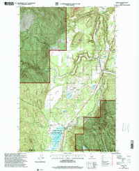
1996 Map of Naples
USGS Topo · Published 1999About this map
Union Pacific railroad tracks follow the valley floor through Boundary County in this 1996 revision of the northern Idaho panhandle. Small settlements and local infrastructure define the corridor, including the community of Naples and the gathering point at the Highland Flats Community Hall. The map reveals a landscape managed for both timber and wildlife, dominated by the Kaniksu National Forest and the Mc Arthur Lake State Wildlife Management Area. The presence of the McArthur Cemetery and the Kootenai Orchard provides specific points of interest for genealogists and local historians tracking family land use and burial sites in this portion of the Selkirk Mountains. Numerous small water bodies like Blue Lake and Stampede Lake are tucked into the drainages of Deep Creek and Fall Creek, illustrating the complex hydrology between Ruby Ridge and Round Mountain.
Find a feature on this map
26 named features on this map. Tap any name to fly to it.
Don’t see what you’re looking for? This feature index may not catch every label — zoom into the map to look around manually.
Map Details
Editions of this 1996 Naples Map
This is the sole edition of this map. No revisions or reprints were ever made.
Other maps of this area

1901 · Sandpoint
USGS Topo · 1:125,000

1911 · Priest Lake
USGS Topo · 1:250,000

1911 · Sandpoint
USGS Topo · 1:125,000

1913 · Priest Lake
USGS Topo · 1:250,000

1951 · Elmira
USGS Topo · 1:62,500

1958 · Sandpoint
USGS Topo · 1:250,000

1963 · Sandpoint
USGS Topo · 1:250,000

1965 · Twentymile Creek
USGS Topo · 1:24,000

1965 · Moravia
USGS Topo · 1:24,000

1965 · Naples
USGS Topo · 1:24,000