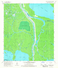
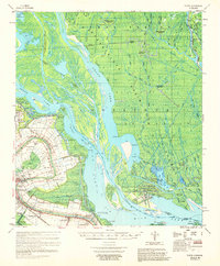
1966 Map of Napoleonville SW
USGS Topo · Published 1967About this map
Stephenville occupies a narrow strip of land along Bayou Long, serving as a focal point for settlement amidst the intricate hydrology of the Louisiana basin. The landscape is defined by the intersection of natural waterways and mid-century industrial development, notably the Intracoastal Waterway and its alternate route. Large-scale aquaculture is represented by a significant Crayfish Farm located central to the map, while energy extraction is evidenced by the West Lake Verret Oil and Gas Field and numerous drill holes scattered across the terrain.
Find a feature on this map
36 named features on this map. Tap any name to fly to it.
Don’t see what you’re looking for? This feature index may not catch every label — zoom into the map to look around manually.
Map Details
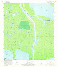
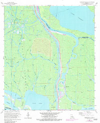
Editions of this 1966 Napoleonville SW Map
4 editions found

Other maps of this area

1935 · Morgan City
USGS Topo · 1:62,500

1941 · Belle Isle
USGS Topo · 1:62,500

1945 · New Orleans
USGS Topo · 1:250,000

1948 · Foster
USGS Topo · 1:62,500
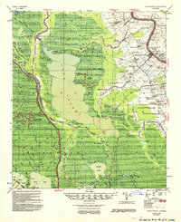
1953 · Napoleonville
USGS Topo · 1:62,500

1954 · Morgan City
USGS Topo · 1:62,500

1954 · Belle Isle
USGS Topo · 1:62,500
1959 · Foster
USGS Topo · 1:62,500

1963 · New Orleans
USGS Topo · 1:250,000
1965 · Grassy Lake
USGS Topo · 1:24,000