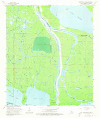
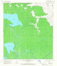
1966 Map of Napoleonville SW
USGS Topo · Published 1973About this map
Stephenville serves as the primary outpost in this water-dominated landscape, situated where the Belle River and Intracoastal Waterway thread through the southern Louisiana wetlands. The 1960s environment is defined by an intricate network of bayous, including Long Bayou, Bayou Milhomme, and Bayou Sorrel, which carve through the Atchafalaya Floodway. The land-water interface is heavily influenced by mid-century resource extraction and aquaculture, evidenced by the presence of an Oil and Gas Field and a large Crayfish Farm in the central swamp.
Find a feature on this map
43 named features on this map. Tap any name to fly to it.
Don’t see what you’re looking for? This feature index may not catch every label — zoom into the map to look around manually.
Map Details
Editions of this 1966 Napoleonville SW Map
4 editions found
Other maps of this area

1935 · Morgan City
USGS Topo · 1:62,500

1941 · Belle Isle
USGS Topo · 1:62,500

1945 · New Orleans
USGS Topo · 1:250,000

1948 · Foster
USGS Topo · 1:62,500

1953 · Napoleonville
USGS Topo · 1:62,500

1954 · Morgan City
USGS Topo · 1:62,500

1954 · Belle Isle
USGS Topo · 1:62,500

1959 · Foster
USGS Topo · 1:62,500

1963 · New Orleans
USGS Topo · 1:250,000
1965 · Grassy Lake
USGS Topo · 1:24,000