
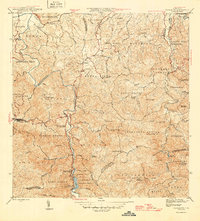
1946 Map of Naranjito
USGS Topo · Published 1946About this map
The Río de la Plata carves a deep, winding path through the center of this mid-century Puerto Rican landscape, serving as a vital corridor for infrastructure. Near the southern municipal border, the Represa de Comerío and the associated Planta Hidroelectrica highlight the era's focus on hydroelectric power development. This topography of steep ridges and numerous quebradas is dotted with various agricultural settlements known as colonias, such as Colonia Piña and Colonia Sabana, alongside established barrios like Minillas.
Find a feature on this map
68 named features on this map. Tap any name to fly to it.
Don’t see what you’re looking for? This feature index may not catch every label — zoom into the map to look around manually.
Map Details
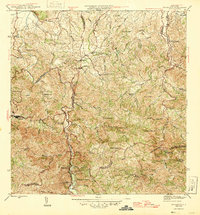
Editions of this 1946 Naranjito Map
3 editions found
Other maps of this area

1940 · Vega Alta
USGS Topo · 1:30,000

1941 · Bayamon
USGS Topo · 1:30,000

1941 · San Juan
USGS Topo · 1:30,000

1946 · Aguas Buenas
USGS Topo · 1:30,000

1946 · Corozal
USGS Topo · 1:30,000

1946 · Barranquitas
USGS Topo · 1:30,000

1946 · Vega Alta
USGS Topo · 1:30,000

1946 · Comerio
USGS Topo · 1:30,000

1946 · Caguas
USGS Topo · 1:30,000
1947 · Naranjito SO
USGS Topo · 1:10,000
Featured Places
- Naranjito
- Sector Correa, Naranjito
- Villas del Olimpo, Bayamón
- Sector La Capilla, Bayamón
- Sector González, Bayamón