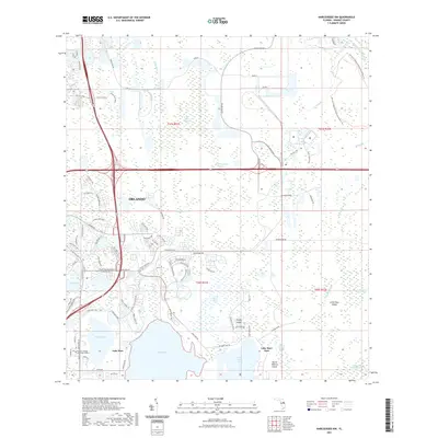
2021 Map of Narcoossee NW
USGS Topo · Published 2021About this map
Orlando's southeastern reaches transition from modern suburban developments into an extensive network of wetlands and conservation lands in this 2021 survey. The landscape is defined by the massive Lake Hart and Lake Mary Jane, separated by a complex of named islands including North Roberts Island and Crosby Island. The presence of the Valencia College Lake Nona Campus highlights the recent educational and residential expansion into this once-rural corridor, where new road networks like Innovation Way and Storey Park Blvd now intersect the ancient hydrology of the region.
Find a feature on this map
96 named features on this map. Tap any name to fly to it.
Don’t see what you’re looking for? This feature index may not catch every label — zoom into the map to look around manually.
Map Details
Editions of this 2021 Narcoossee NW Map
This is the sole edition of this map. No revisions or reprints were ever made.
Other maps of this area

1953 · Narcoossee NE
USGS Topo · 1:24,000

1953 · Narcoossee SE
USGS Topo · 1:24,000

1953 · St Cloud North
USGS Topo · 1:24,000

1953 · Narcoossee
USGS Topo · 1:24,000

1953 · Pine Castle
USGS Topo · 1:24,000

1953 · Oviedo SW
USGS Topo · 1:24,000

1953 · Narcoossee NW
USGS Topo · 1:24,000

1953 · Bithlo
USGS Topo · 1:24,000

1955 · Orlando
USGS Topo · 1:250,000

1956 · Orlando East
USGS Topo · 1:24,000