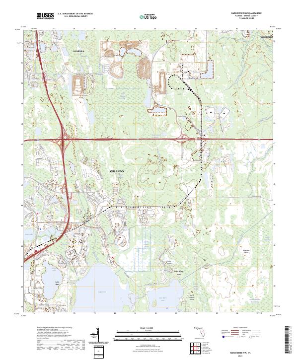
2024 Map of Narcoossee NW
USGS Topo · Published 2024About this map
Wide Cypress Swamp and the Econlockhatchee River Swamp dominate this central Florida landscape, revealing the intricate water systems south of Alafaya and east of Orlando. The map documents a territory defined by large water bodies like Lake Hart and Lake Mary Jane, separated by low-lying features such as Crosby Island and the Crosby Island Marsh. Modern educational and recreational infrastructure is increasingly integrated into the terrain, evidenced by the Valencia College - Lake Nona Campus and a network of conservation paths including the Split Oak Forest Trail South Trl. This documentation captures the persistent presence of the Disston Canal, a historical water management feature, alongside the encroaching residential developments of Wedgefield. The hydrological pattern of branches and creeks, such as Turkey Creek and Cowpen Branch, illustrates the natural drainage pathways that have shaped the region's development.
Find a feature on this map
153 named features on this map. Tap any name to fly to it.
Don’t see what you’re looking for? This feature index may not catch every label — zoom into the map to look around manually.
Map Details
Editions of this 2024 Narcoossee NW Map
This is the sole edition of this map. No revisions or reprints were ever made.
Other maps of this area

1953 · Narcoossee NE
USGS Topo · 1:24,000

1953 · Narcoossee SE
USGS Topo · 1:24,000

1953 · St Cloud North
USGS Topo · 1:24,000

1953 · Narcoossee
USGS Topo · 1:24,000

1953 · Pine Castle
USGS Topo · 1:24,000

1953 · Oviedo SW
USGS Topo · 1:24,000

1953 · Narcoossee NW
USGS Topo · 1:24,000

1953 · Bithlo
USGS Topo · 1:24,000

1955 · Orlando
USGS Topo · 1:250,000

1956 · Orlando East
USGS Topo · 1:24,000