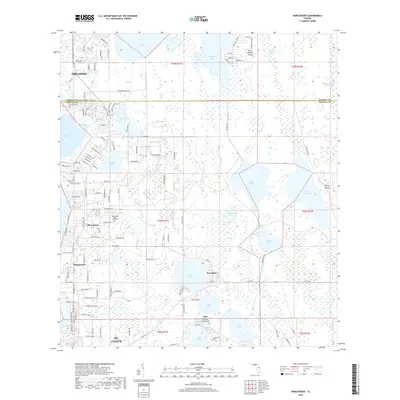
2018 Map of Narcoossee
USGS Topo · Published 2018About this map
Narcoossee and its surrounding lakefront settlements define this Central Florida landscape during a period of residential growth. Situated along the boundary of Orange and Osceola counties, the area is characterized by a dense network of water bodies, including the expansive E Lake Tohopekaliga and Lake Hart. The map records the local infrastructure of communities such as Runnymede, New Eden, and Pine Grove, providing a clear view of the transition from rural acreage to suburban development. Genealogists will find particular value in the location of the Narcoussee Arthur Fell Cem and the naming of many local thoroughfares like Clapp Simms Duda Rd and Leon Tyson Rd. The eastern portion of the map remains less developed, dominated by the Econlockhatchee River Swamp and the large, interconnected basins of Lake Myrtle and Lake Preston.
Find a feature on this map
138 named features on this map. Tap any name to fly to it.
Don’t see what you’re looking for? This feature index may not catch every label — zoom into the map to look around manually.
Map Details
Editions of this 2018 Narcoossee Map
This is the sole edition of this map. No revisions or reprints were ever made.
Other maps of this area

1953 · Narcoossee NE
USGS Topo · 1:24,000

1953 · Narcoossee SE
USGS Topo · 1:24,000

1953 · St Cloud North
USGS Topo · 1:24,000

1953 · Narcoossee
USGS Topo · 1:24,000

1953 · St Cloud South
USGS Topo · 1:24,000

1953 · Ashton
USGS Topo · 1:24,000

1953 · Holopaw
USGS Topo · 1:24,000

1953 · Pine Castle
USGS Topo · 1:24,000

1953 · Narcoossee NW
USGS Topo · 1:24,000

1955 · Orlando
USGS Topo · 1:250,000