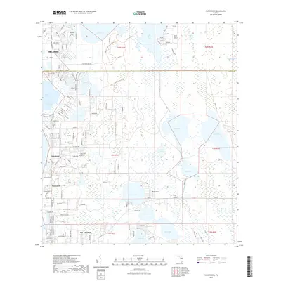
2021 Map of Narcoossee
USGS Topo · Published 2021About this map
Narcoossee and the northern edge of St. Cloud sit at the center of a landscape defined by an intricate network of interconnected freshwater basins. The transition from Orange County to Osceola County is marked by water, with East Lake Tohopekaliga and Lake Hart anchoring a territory of wetlands and cypress strands like the Econlockhatchee River Swamp. The map documents the persistent identity of small communities like Runnymede, New Eden, and Pine Grove as they navigate the shifting boundaries between rural preservation and the outward reach of Orlando. Local history is preserved at the Arthur Fell Cemetery and along the shores of Lake Mary Jane, while recreational corridors such as the Moss Park Trail and Lake Loop Trail wind through the remaining natural acreage near North Roberts Island.
Find a feature on this map
51 named features on this map. Tap any name to fly to it.
Don’t see what you’re looking for? This feature index may not catch every label — zoom into the map to look around manually.
Map Details
Editions of this 2021 Narcoossee Map
This is the sole edition of this map. No revisions or reprints were ever made.
Other maps of this area

1953 · Narcoossee NE
USGS Topo · 1:24,000

1953 · Narcoossee SE
USGS Topo · 1:24,000

1953 · St Cloud North
USGS Topo · 1:24,000

1953 · Narcoossee
USGS Topo · 1:24,000

1953 · St Cloud South
USGS Topo · 1:24,000

1953 · Ashton
USGS Topo · 1:24,000

1953 · Holopaw
USGS Topo · 1:24,000

1953 · Pine Castle
USGS Topo · 1:24,000

1953 · Narcoossee NW
USGS Topo · 1:24,000

1955 · Orlando
USGS Topo · 1:250,000