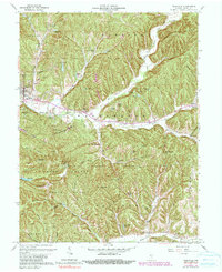
1961 Map of Nashville
USGS Topo · Published 1990About this map
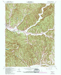
Nashville serves as the focal point for this survey of central Brown County, characterized by its dense network of ridges and hollows that define the local geography. The landscape is dominated by the sprawling Brown County State Park, which includes landmark elevations such as Weed Patch Hill and Town Hill. The area's mid-century recreational and conservation character is evident in the numerous small reservoirs like Ogle Lake and Strahl Lake, as well as the Abe Martin Lodge. Cultural heritage is preserved through features like the Covered Bridge over the North Fork Salt Creek and scattered rural settlements such as Gnaw Bone and Stone Head. The map detail also captures vital community infrastructure, from the County High Sch in Nashville to remote burial sites like the David Cem and Couch Cem, offering a comprehensive view of the county seat and its wooded surroundings during the early 1960s.
Find a feature on this map
89 named features on this map. Tap any name to fly to it.
Don’t see what you’re looking for? This feature index may not catch every label — zoom into the map to look around manually.
Map Details
Editions of this 1961 Nashville Map
5 editions found
Other maps of this area

1942 · Franklin
USGS Topo · 1:125,000

1946 · Belmont
USGS Topo · 1:24,000

1947 · Nashville
USGS Topo · 1:24,000

1947 · Elkinsville
USGS Topo · 1:24,000

1947 · Franklin
USGS Topo · 1:62,500

1948 · New Bellsville
USGS Topo · 1:24,000

1948 · Waymansville
USGS Topo · 1:24,000

1948 · Nineveh
USGS Topo · 1:24,000

1948 · Fruitdale
USGS Topo · 1:24,000

1948 · Morgantown
USGS Topo · 1:24,000