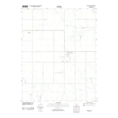
2010 Map of Nashville
USGS Topo · Published 2010About this map
Nashville serves as the central hub of this Kingman County landscape, situated at the junction of Quivera Rd and SW 170 Ave. The town’s grid is flanked by the Nashville Cemetery and Saint John Cemetery to its west, while the more remote Bross Cemetery lies to the northeast near the Chikaskia River. The drainage pattern of the region is defined by several waterways, including Skunk Creek and Morisse Creek, which cut through the agricultural sections south and east of the town center. To the northwest, the Van Rankin Landing Strip provides a point of interest for those tracing aviation history in rural Kansas. The map's network of gravel and paved roads, such as Mineral Rd and Kingman Rd, reveals the enduring rectilinear organization of the prairie, where small tributaries like Chicken Creek and Sand Creek wind through the section lines.
Find a feature on this map
31 named features on this map. Tap any name to fly to it.
Don’t see what you’re looking for? This feature index may not catch every label — zoom into the map to look around manually.
Map Details
Editions of this 2010 Nashville Map
This is the sole edition of this map. No revisions or reprints were ever made.
Other maps of this area

1889 · Anthony
USGS Topo · 1:125,000

1891 · Medicine Lodge
USGS Topo · 1:125,000

1891 · Anthony
USGS Topo · 1:125,000

1892 · Kingman
USGS Topo · 1:125,000

1892 · Pratt
USGS Topo · 1:125,000

1893 · Medicine Lodge
USGS Topo · 1:125,000

1894 · Kingman
USGS Topo · 1:125,000

1894 · Pratt
USGS Topo · 1:125,000

1955 · Pratt
USGS Topo · 1:250,000

1959 · Pratt
USGS Topo · 1:250,000