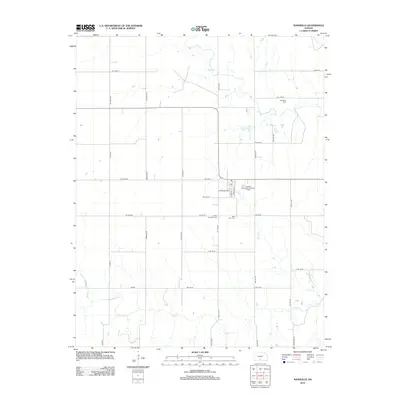
2012 Map of Nashville
USGS Topo · Published 2012About this map
Nashville and its surrounding prairie landscape in Kingman County are defined by a structured grid of rural roads and the winding paths of Sand Cr and Skunk Cr. This 2012 survey reveals a quiet agricultural region where local history is preserved in small, dispersed burial grounds such as Old Bross Cem, located along SW 120 St, and the Liberty Township Cem near the town center. The settlement of Nashville itself is oriented around the Po and W Central Ave, with modern infrastructure represented by the Nashville Wastewater Treatment Facility. The map captures the enduring rural character of the Kansas plains, showing how transportation arteries like Kingman Rd and Co Rd 59 connect isolated farmsteads and township cemeteries, providing a detailed record of land use and community layout in the early 21st century.
Find a feature on this map
35 named features on this map. Tap any name to fly to it.
Don’t see what you’re looking for? This feature index may not catch every label — zoom into the map to look around manually.
Map Details
Editions of this 2012 Nashville Map
This is the sole edition of this map. No revisions or reprints were ever made.
Other maps of this area

1889 · Anthony
USGS Topo · 1:125,000

1891 · Medicine Lodge
USGS Topo · 1:125,000

1891 · Anthony
USGS Topo · 1:125,000

1892 · Kingman
USGS Topo · 1:125,000

1892 · Pratt
USGS Topo · 1:125,000

1893 · Medicine Lodge
USGS Topo · 1:125,000

1894 · Kingman
USGS Topo · 1:125,000

1894 · Pratt
USGS Topo · 1:125,000

1955 · Pratt
USGS Topo · 1:250,000

1959 · Pratt
USGS Topo · 1:250,000