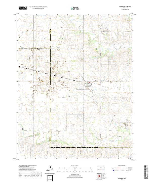
2022 Map of Nashville
USGS Topo · Published 2022About this map
Nashville serves as the primary hub of this rural landscape where the borders of Kingman, Pratt, and Barber counties converge. The town's grid is anchored by W Central Ave, surrounded by a landscape of rolling terrain and drainage basins. For family historians, the presence of several well-established burial grounds provides a clear record of local settlement patterns, including Old Bross Cem in the northeast and both Liberty Cem and Saint John Cem further south. The hydrography is defined by the winding paths of Skunk Cr and Sand Cr, which cut through the agricultural sections. A network of section-line roads, such as Quivera Rd and Mineral Rd, organizes the territory into a distinct prairie grid, reflecting a century of land management and rural habitation in south-central Kansas.
Find a feature on this map
32 named features on this map. Tap any name to fly to it.
Don’t see what you’re looking for? This feature index may not catch every label — zoom into the map to look around manually.
Map Details
Editions of this 2022 Nashville Map
This is the sole edition of this map. No revisions or reprints were ever made.
Other maps of this area

1889 · Anthony
USGS Topo · 1:125,000

1891 · Medicine Lodge
USGS Topo · 1:125,000

1891 · Anthony
USGS Topo · 1:125,000

1892 · Kingman
USGS Topo · 1:125,000

1892 · Pratt
USGS Topo · 1:125,000

1893 · Medicine Lodge
USGS Topo · 1:125,000

1894 · Kingman
USGS Topo · 1:125,000

1894 · Pratt
USGS Topo · 1:125,000

1955 · Pratt
USGS Topo · 1:250,000

1959 · Pratt
USGS Topo · 1:250,000