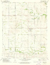
1973 Map of Nashville
USGS Topo · Published 1975About this map
The town of Nashville serves as the central hub of this South Central Kansas landscape, positioned where the Atchison Topeka and Santa Fe railroad bisects the prairie. A historical through-line is preserved in the Old Indian Treaty Boundary, which runs east-to-west across the northern portion of the map, marking an early era of land division and settlement. The terrain is defined by the drainage of the Chikaskia River and its numerous tributaries, including Skunk Creek, Sand Creek, and Morrissey Creek. Local history is anchored by several burial grounds, such as Nashville Cem and St John Cem south of town, and Bross Cem to the northeast. Rural infrastructure is further evidenced by the Van Rankin Landing Strip and various resource extraction points like a Gravel Pit and scattered Well sites.
Find a feature on this map
27 named features on this map. Tap any name to fly to it.
Don’t see what you’re looking for? This feature index may not catch every label — zoom into the map to look around manually.
Map Details
Editions of this 1973 Nashville Map
This is the sole edition of this map. No revisions or reprints were ever made.
Other maps of this area

1889 · Anthony
USGS Topo · 1:125,000

1891 · Medicine Lodge
USGS Topo · 1:125,000

1891 · Anthony
USGS Topo · 1:125,000

1892 · Kingman
USGS Topo · 1:125,000

1892 · Pratt
USGS Topo · 1:125,000

1893 · Medicine Lodge
USGS Topo · 1:125,000

1894 · Kingman
USGS Topo · 1:125,000

1894 · Pratt
USGS Topo · 1:125,000

1955 · Pratt
USGS Topo · 1:250,000

1959 · Pratt
USGS Topo · 1:250,000