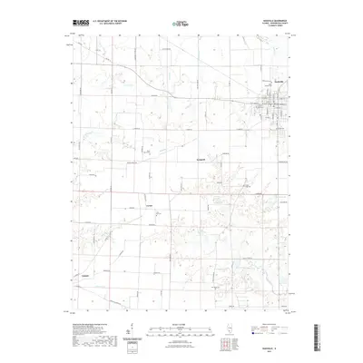
2021 Map of Nashville
USGS Topo · Published 2021About this map
Nashville serves as the regional hub in this part of Washington County, showing a dense street grid organized around thoroughfares like W Saint Louis St and S Broadway St. The surrounding landscape is defined by the winding paths of Locust Creek and Willow Cr, which drain into several small reservoirs including Lanes Lake and Piney Wood Lake. Historically significant sites are scattered throughout the rural sections, anchored by local centers such as Cordes, Kempside, and the edge of Oakdale. Genealogists will find several well-marked burial grounds including Trinity Lutheran Cem and Saint Paul Cem, reflecting the area's long-standing community foundations. The network of county roads, such as Co Hwy 21, connects these isolated settlements through a landscape of creek-cut valleys and upland farms.
Find a feature on this map
79 named features on this map. Tap any name to fly to it.
Don’t see what you’re looking for? This feature index may not catch every label — zoom into the map to look around manually.
Map Details
Editions of this 2021 Nashville Map
This is the sole edition of this map. No revisions or reprints were ever made.
Other maps of this area

1910 · Okawville
USGS Topo · 1:62,500

1914 · Coulterville
USGS Topo · 1:62,500

1917 · Coulterville
USGS Topo · 1:62,500

1924 · Pinckneyville
USGS Topo · 1:62,500

1926 · Pinckneyville
USGS Topo · 1:62,500

1931 · Hoyleton
USGS Topo · 1:48,000

1932 · Nashville
USGS Topo · 1:62,500

1936 · Nashville
USGS Topo · 1:62,500

1940 · Okawville
USGS Topo · 1:62,500

1958 · Belleville
USGS Topo · 1:250,000