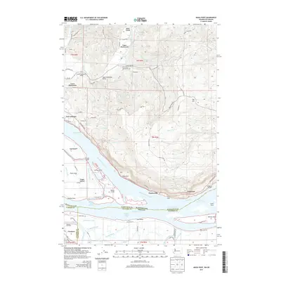
2014 Map of Nassa Point
USGS Topo · Published 2014About this map
Puget Island and a intricate network of sloughs and channels dominate this reach of the Columbia River on the border of Washington and Oregon. The map documents the complex hydrology of the estuary, featuring numerous named waterways like Sturgeon Pen Slough, Birnie Slough, and Eureka Upper Channel. Along the northern banks, the Elochoman River winds through small rural communities including Upper Elochoman and Lower Elochoman, where the Beaver Creek State Fish Hatchery is a notable facility near the valley floor.
Find a feature on this map
88 named features on this map. Tap any name to fly to it.
Don’t see what you’re looking for? This feature index may not catch every label — zoom into the map to look around manually.
Map Details
Editions of this 2014 Nassa Point Map
This is the sole edition of this map. No revisions or reprints were ever made.
Other maps of this area

1919 · Mayger
USGS Topo · 1:62,500

1941 · Skamokawa
USGS Topo · 1:62,500

1941 · Clatskanie
USGS Topo · 1:62,500

1941 · Cathlamet
USGS Topo · 1:62,500

1952 · Clatskanie
USGS Topo · 1:62,500

1953 · Hoquiam
USGS Topo · 1:250,000

1953 · Ryderwood
USGS Topo · 1:62,500

1953 · Skamokawa
USGS Topo · 1:62,500

1953 · Cathlamet
USGS Topo · 1:62,500

1957 · Hoquiam
USGS Topo · 1:250,000