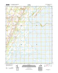
2013 Map of Nassawadox
USGS Topo · Published 2013About this map
Nassawadox and its surrounding hamlets occupy the narrow interior of the Eastern Shore, where the landscape is defined by an intricate network of tidal guts and winding creeks. The western portion of the map follows the corridor of the Lankford Hwy, connecting established communities like Weirwood, Marionville, and Hare Valley. These settlements are closely tied to the land's transition from agricultural fields to the salt marshes of the Atlantic coast.
Find a feature on this map
72 named features on this map. Tap any name to fly to it.
Don’t see what you’re looking for? This feature index may not catch every label — zoom into the map to look around manually.
Map Details
Editions of this 2013 Nassawadox Map
This is the sole edition of this map. No revisions or reprints were ever made.
Other maps of this area

1931 · Accomac
USGS Topo · 1:48,000

1935 · Accomac
USGS Topo · 1:62,500

1941 · Broadwater
USGS Topo · 1:62,500

1942 · Cheriton
USGS Topo · 1:24,000

1942 · Cobb Island
USGS Topo · 1:24,000

1942 · Great Machipongo Inlet
USGS Topo · 1:24,000

1942 · Little Machipongo Inlet
USGS Topo · 1:24,000

1942 · Nassawadox
USGS Topo · 1:24,000

1943 · Nassawadox
USGS Topo · 1:31,680

1943 · Jamesville
USGS Topo · 1:31,680