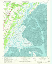
1968 Map of Nassawadox
USGS Topo · Published 1971About this map
Nassawadox and its neighboring communities on the Virginia Eastern Shore are captured here during a period of transition in the late 1960s. The landscape is defined by the sharp contrast between the agricultural uplands and the intricate saltwater marshes of the Atlantic coast. The Penn Central railroad serves as the spine of the region, connecting inland settlements like Weirwood, Marionville, and Middletown. To the east, the map reveals a complex network of tidal guts and marshes including Crabbing Marsh and Short Prong Marsh, demonstrating how the geography of Brickhouse Neck and Upshur Neck dictated local movement and industry.
Find a feature on this map
55 named features on this map. Tap any name to fly to it.
Don’t see what you’re looking for? This feature index may not catch every label — zoom into the map to look around manually.
Map Details
Editions of this 1968 Nassawadox Map
2 editions found
Other maps of this area

1931 · Accomac
USGS Topo · 1:48,000

1935 · Accomac
USGS Topo · 1:62,500

1941 · Broadwater
USGS Topo · 1:62,500

1942 · Cheriton
USGS Topo · 1:24,000

1942 · Cobb Island
USGS Topo · 1:24,000

1942 · Great Machipongo Inlet
USGS Topo · 1:24,000

1942 · Little Machipongo Inlet
USGS Topo · 1:24,000

1942 · Nassawadox
USGS Topo · 1:24,000

1943 · Nassawadox
USGS Topo · 1:31,680

1943 · Jamesville
USGS Topo · 1:31,680